
Urartu: the Kingdom of Van
Between the ninth and sixth centuries BC, a federation of mountain principalities around Lake Van grew into one of the strongest states of the ancient Near East. Assyrian scribes called it Urartu, its own kings called it Biainili, and later Greek and Armenian writers remembered its cities long after its palaces had burned. For students of Armenian history, Urartu is where written evidence about life on the Armenian Highlands truly begins.
- Author
- Armat Editorial Team
- Updated
- Reading time
- 12 min read
In brief
Urartu was a state that existed around Lake Van from the ninth century BC to the beginning of the sixth: the earliest kingdom of the Armenian Highlands for which we have both its own written records and extensive archaeological material. Its capital was Tushpa, on the rock of Van. At the height of its power, under Menua, Argishti I and Sarduri II, the kingdom controlled territory stretching toward Lake Sevan and Lake Urmia and competed with Assyria for the trade routes of the region. Its most visible legacy is its fortresses and its water engineering: Argishti I's Erebuni of 782 BC gave Yerevan its name, and Menua's canal still carries water to the fields near Van.
Key facts
- Native name
- Biainili, the land around Lake Van
- Capital
- Tushpa, on the rock of Van
- Approximate dates
- About 860 to 590 BC
- Language and script
- Urartian, written in cuneiform borrowed from Assyria
- Chief deity
- Haldi, god of war and kingship
- Famous foundation
- Erebuni, founded in 782 BC, ancestor of Yerevan
Urartu, Biainili, Van, Ararat: four names for one state
This state appears in scholarly and school literature under several different names, and that usually causes confusion. The names all refer to one state; what differs is who did the naming, and when. The form Urartu is Assyrian: it is what the scribes of the neighbouring empire called the country they fought for two centuries, and because the Assyrian annals are among the earliest written references to this region, that is the form that passed into European scholarship.
The Urartian kings themselves called their country Biainili in their own inscriptions, the land around Lake Van. It is this word that connects, through a long chain of linguistic change, to the place name Van, and it is from this genuine self-designation that the form Kingdom of Van used in Armenian historiography derives — the form under which the state is usually presented in Armenian-language educational writing. Assyrian sources also used the name Nairi for the lands of the same region, and the Urartian kings adopted it into their titles: the inscription of Sarduri I calls him king of the land of Nairi.
The fourth name comes from the Bible. The Ararat of the Hebrew text is accepted in scholarship as a rendering of the same name Urartu in the Hebrew consonantal script, and it is from this form that the name Ararat kingdom arises, used in Armenian alongside Kingdom of Van. It is worth noting that this is the name of a state and not the name of Mount Ararat: the connection between the two is one of naming, and Urartian inscriptions do not call that mountain by this name.
One thing these names do not tell us is the linguistic affiliation of the Urartians. Urartian is related to Hurrian and does not belong to the Indo-European family, so it is not an ancestor of Armenian. The use of the forms Kingdom of Van and Ararat kingdom in Armenian historiography rests on geography and on later historical continuity rather than on linguistic descent, and confusing the two is the commonest error on this subject.
The land and its people
The heartland of Urartu lay on the volcanic plateau surrounding Lake Van, in what is today eastern Turkey, and at its widest reach the kingdom controlled territory stretching toward Lake Sevan and Lake Urmia. This is high, difficult country, cut by mountain ridges and fed by short, fast rivers. Winters are long and snow closes the passes for months, while the summer sun bakes the valley floors. Any state that wanted to survive here had to master two things at once: the storage of water and the defence of narrow mountain routes.
The Urartians spoke a language related to Hurrian and unrelated to the Indo-European family, and they wrote it using a cuneiform script borrowed from Assyria. Hundreds of their royal inscriptions survive on cliff faces, temple walls and stone blocks, describing building projects, campaigns and offerings to the gods. Because these inscriptions are formulaic, historians read them carefully and compare them with Assyrian annals written by Urartu's rivals, which describe the same events from the opposite direction.
The population of the kingdom was probably mixed from the beginning. Urartian rulers governed a patchwork of valleys with their own local chiefs, languages and traditions, and the royal texts often list conquered districts by name. Most scholars now think that speakers of early Armenian lived within or beside this world, and that the collapse of the Urartian state helped an Armenian-speaking population become dominant across the same highlands.
Kings, fortresses and expansion
The traditional founder of the unified kingdom is Aramu, mentioned in Assyrian records around 860 BC. His successor Sarduri I established the capital at Tushpa on the rock of Van, where his inscription proudly names him king of the universe and king of the land of Nairi. Later rulers, above all Menua, Argishti I and Sarduri II, pushed Urartian control north into the Ararat plain and east toward the Caspian slope, turning a defensive federation into an empire that could challenge Assyria for control of the trade routes of the region.
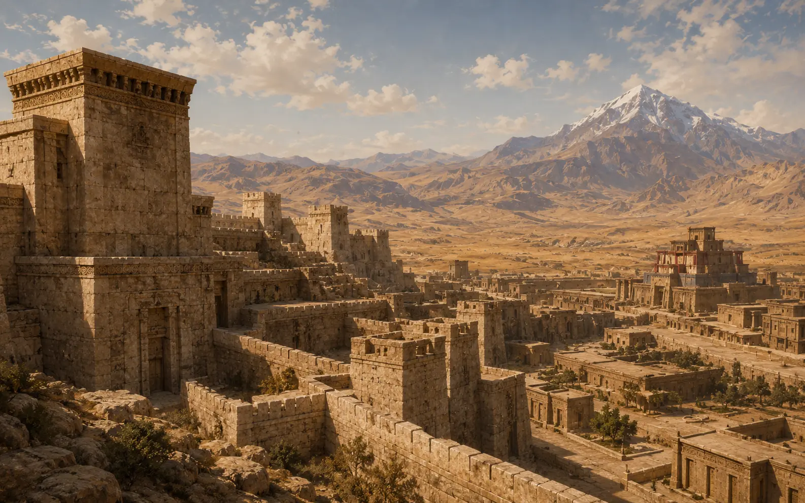
Urartian power rested on fortresses. Royal engineers chose steep outcrops, cut terraces into the rock, and raised massive stone foundations topped by mudbrick walls. Inside these citadels stood temples, barracks and enormous storerooms lined with jars for grain, wine and oil. Erebuni, founded by Argishti I in 782 BC above the modern city of Yerevan, and Teishebaini at Karmir Blur are among the best excavated examples, and their storage capacity shows how carefully the state gathered and redistributed the harvest.
Warfare and diplomacy alternated across two centuries. Urartu suffered a serious defeat when the Assyrian king Sargon II campaigned in the region in 714 BC, sacking the sanctuary of Musasir and carrying off its treasures. Yet the kingdom recovered and continued to build, raising fortresses even in the last decades of its existence.
- Aramu, first Urartian king named in Assyrian sources, around 860 BC
- Sarduri I, founder of the capital Tushpa on the rock of Van
- Menua, builder of the great canal that still carries water near Van
- Argishti I, founder of Erebuni in 782 BC
- Rusa II, builder of Teishebaini and other late fortresses
Water, farming and metalwork
The achievement that most impresses modern engineers is Urartian hydraulics. The canal built under King Menua runs for more than fifty kilometres, carrying fresh water from mountain springs to the fields around Van, and parts of it still function today. Urartian builders also created reservoirs by damming mountain valleys, and several of these artificial lakes remain in use. These works transformed a dry plateau into land that could support cities, and they required both surveying skill and the ability to organise large numbers of workers.
With irrigation came orchards and vineyards. Storerooms at excavated fortresses have yielded rows of huge clay jars marked with capacity signs, along with carbonised grain, grape seeds and traces of wine and sesame oil. Cattle, sheep and horses were central to the economy, and Urartian horses were valued across the Near East. The state kept careful accounts, and the standardised jar marks are early evidence of a bureaucratic system that measured and taxed agricultural surplus.
Urartian metalworkers were equally admired. Bronze cauldrons with bull-headed handles, decorated helmets, shields, quivers and delicate belt plaques have been found from the Armenian Highlands to Greek and Etruscan sites, showing that Urartian workshops supplied a wide export market. Many of these objects carry royal inscriptions, which means that even luxury goods served to advertise the authority of the king.
Gods and sacred places
The Urartian pantheon is known chiefly from a long inscription carved into the rock niches at Meher Dur near Van, which lists dozens of deities and the exact offerings due to each. At the head of the list stands Haldi, the supreme god of war and kingship, followed by Teisheba, a storm god, and Shivini, a sun god. Kings described their victories as the achievements of Haldi, and campaigns were often launched from his sanctuaries.
Urartian temples were compact square towers with thick walls, set within fortress courtyards. Around them archaeologists have found altars, sacrificial deposits and stelae recording gifts of livestock. The sanctuary of Musasir, shown in an Assyrian relief with a columned porch and a triangular gable, was the most famous of these shrines, and its loss to Sargon II in 714 BC was treated as a national catastrophe.
Burial customs varied. Rock-cut chambers held the remains of the elite together with jewellery, weapons and vessels, while cremation urns have been found in cemeteries near several fortresses. Together with the temple inscriptions, these graves suggest a religion focused on the protection of the community by powerful divine patrons rather than on elaborate ideas of personal afterlife.
The fall of the kingdom
Urartu ceased to exist in the early sixth century BC, and this is the worst-documented part of the kingdom's history. No Urartian inscription describes the end of the state: the royal texts break off, and the next written evidence in which this territory appears is already Persian and calls the region Armina. Everything about the fall is therefore reconstructed indirectly, from archaeology and from the history of the neighbours.
The difficulty is compounded by the loss, in the same period, of the source that observed Urartu from outside. Assyria — Urartu's chief rival and the author of the richest external testimony about it — itself collapsed in 612 BC. At precisely the moment Urartu was approaching its end, the steady flow of records about it stops as well. This is why the exact date and the circumstances of the fall remain an open question.
What is usually named as a combination of pressures includes Median expansion from the east and incursions by nomadic peoples from the north. Archaeology confirms that the end was violent in at least some centres: excavations at the fortress of Teishebaini at Karmir Blur have exposed a destruction layer with traces of fire, and this fortress was one of the largest building projects of the late period. At the same time it should be remembered that the destruction of one fortress is not an explanation for the fall of an entire state.
There is also a second, non-military explanation that receives more attention today. Urartian power rested on fortresses, storerooms and a strictly centralised system of redistribution. A structure of that kind is strong for as long as the centre functions, and quickly becomes useless once the centre stops gathering and distributing the harvest. The available evidence therefore gives no final answer to the question of conquest or collapse, and the most cautious formulation is that external pressure and the vulnerability of the internal system worked together.
What is not in dispute is that the state disappeared and that what it had built did not. In the following centuries the Armenian Highlands passed under Median and then Achaemenid rule, and a united Armenian kingdom would reach its greatest extent very much later, under Tigran the Great.
From Urartu to Armenia
The Urartian state disappeared in the early sixth century BC, but the landscape it built did not. Canals kept flowing, fortress mounds remained visible, and the settlements founded by Urartian kings often continued as villages and towns. Erebuni gave its name, through a long chain of sound changes, to Yerevan, and the city officially dates its foundation to Argishti's inscription of 782 BC, which makes it older than Rome.
Ancient Armenian tradition preserved a memory of this era in legendary form. The story of Ara the Handsome and the Assyrian queen Shamiram, retold by the historian Movses Khorenatsi, places a great builder queen at Van and credits her with the canal and the cliff inscriptions. Modern scholarship attributes those works to Menua, but the legend shows that the monuments never stopped being explained and reinterpreted.
For historians today, Urartu matters because it provides the first detailed written and archaeological picture of organised life in the Armenian Highlands. Studying it teaches a valuable lesson about evidence: royal inscriptions, enemy chronicles, excavated storerooms and later legends each tell part of the story, and only by reading them together can we reconstruct what actually happened.
Important dates
c. 860 BC
Assyrian records name Aramu as king of Urartu, the first ruler known by name.
c. 832 BC
Sarduri I establishes the capital at Tushpa and leaves the earliest royal inscription at Van.
c. 800 BC
King Menua builds the great canal and expands the kingdom northward.
782 BC
Argishti I founds the fortress of Erebuni on the hill of Arin Berd.
714 BC
Sargon II of Assyria campaigns against Urartu and sacks the sanctuary of Musasir.
c. 590 BC
The Urartian state collapses; Persian sources soon refer to the region as Armina.
Why the Kingdom of Urartu matters
Urartu is the earliest state on the Armenian Highlands that we can study in detail from its own written records. Its inscriptions, fortresses and canals show a society capable of long-term planning, large public works and sustained resistance to the greatest military power of the age. That evidence gives Armenian history a documented starting point rather than a purely legendary one.
The kingdom also shaped what came after it. Cities founded by Urartian kings became the towns of later Armenia, its irrigation systems continued to water the same fields, and the political idea of a single power ruling the highlands from a fortified centre survived the fall of the dynasty. When Armenian-speaking rulers appear in Persian and Greek sources a few generations later, they inherit a landscape that Urartu had already organised.
Interesting facts
- 01Yerevan celebrates its birthday using the Urartian foundation inscription of Erebuni, making it one of the oldest continuously inhabited cities in the world.
- 02The canal built by King Menua around 800 BC still carries water to fields near Van after roughly twenty-eight centuries.
- 03Urartian bronze cauldrons have been found as far west as Greece and Italy, evidence of a long-distance luxury trade.
- 04The Urartian language is related to Hurrian and is not connected to Armenian, even though the two peoples shared the same highlands.
- 05Storage jars in Urartian fortresses were marked with capacity signs, an early form of standardised state accounting.
Sources
- Paul E. Zimansky. Ancient Ararat: A Handbook of Urartian Studies — Caravan Books, Delmar NY, 1998 ISBN 9780882060910
- Boris B. Piotrovsky. The Ancient Civilization of Urartu — Cowles, New York, 1969 Visit sourcePiotrovsky directed the Karmir Blur excavations from 1939 to 1971.
- Mirjo Salvini. Corpus dei testi urartei — CNR, Istituto di Studi sulle Civiltà dell'Egeo e del Vicino Oriente, Rome, 2008– ISBN 9788878900257The standard edition of the Urartian royal inscriptions.
Related articles
Tigran the Great
The Artaxiad king who expanded Armenia into the strongest state of the Near East, founded Tigranocerta, and met the Roman legions of Lucullus and Pompey.
The Adoption of Christianity in Armenia (301)
Armenia is traditionally recognised as the first state to adopt Christianity as its official religion, a decision that reshaped its law, art and identity.

Mesrop Mashtots and the Armenian Alphabet
Around 405 the scholar and monk Mesrop Mashtots created an alphabet that gave Armenian its own written voice and reshaped the nation's culture.